Wednesday, May 18, 2022

Waveland Park

 April 19, 2022

As we generally like to do we camped on weekdays at Waveland Park. Its always quieter mid-week so we arrived on Monday and stayed until Friday. Just one of the benefits of being retired. We stayed in site #36 along the lower loop of the park which was relatively secluded being the last site on the road and back in the trees. Many of the sites at Waveland appear to have been recently updated with new cooking tables and firepit grills. 

Blue Mountain Lake was very high when we arrived due to recent rain and additional rain caused the lake to rise even more during our stay. Per the Corp of Engineers the normal springtime lake elevation is 387', but it was around 395' for he week we were there. At this level the lower road around the park and the parking lot at the swim beach was under water.  

Kayaks in the Flooded Parking Lot at the Swim Beach
We drove over the mountain at the dam to see what the discharge looked like at Outlet Park. It was roaring pretty down the Petit Jean River. 
The water flowing through the tunnel under the mountain reforms the Petit Jean River at Outlet Park before continuing to the Arkansas River near Petit Jean Mountain.

View from the Overlook above Outlet Park
Sunset from the Levy near the Discharge Structure
Tuesday was waterfall adventure day! We first ventured south of Havana to Kirkwood Falls and then north to Big Shoal Falls near Paris. 

Kirkwood Falls was easy to access on Yell county roads 27 and 519. The road from highway 309 runs adjacent to several farms so Donna go to see lots of cows. We think a calf we saw with mom had to have been born just that morning. The falls were just off the road (no hike required).
Kirkland Falls near Havana Arkansas

The second water fall of the day was Big Shoal Falls. We headed north on highway 309 toward Mount Magazine. Heading up Mount Magazine we decided to follow Google map directions to the falls rather than the route from the Paris side of the mountain, We should have stopped when we saw the hand painted sign "Road Construction Ahead". How bad could it be? Pretty bad. For about 6 miles we followed the newly bulldozed, red clay Barber Ridge Road and Valentine Road. Thank goodness for four wheel drive and the engine skid plate. We finally came out on Spring Lake Road. A well maintained heavy duty county road that we should have taken to begin with. Big Shoal Falls can be seen from Spring Lake Road and has a half circle drive that crosses the shoal like a low water bridge.
Big Shoal Falls near Paris Arkansas
We flew the drone and got some some good aerial photos and video of the area.


A few pictures from around the campground. From these pictures you can see the closed roads and submerged parkinglot.
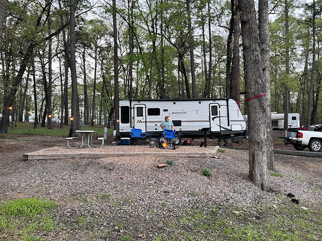
Donna Starting an Evening Campfire
Dinner on the Grill
Chillin' After a Day of Waterfall Chasing

Sunday, March 27, 2022

Cane Creek State Park

 March 27, 2022

For our first trip of 2022 we decided to go to Cane Creek State Park at Star City, Arkansas. This was also our first trip to Cane Creek State Park. Over the years we have been to nearby Star City and the Butler Hunting Club, each only a few miles from the park. The park is situated on Cane Creek Lake at a point where the Coastal Plain meets the Mississippi Delta. Bayou Bartholomew is to the East of the park where overflow from Cane Creek Lake goes into the bayou at a spillway. Bayou Bartholomew is the longest bayou in the world, it meanders from near where I grew up in Pine Bluff approximately 364 miles through Arkansas and Louisiana. I grew up playing in the woods around Bayou Bartholomew south of Pine Bluff.


We arrived Sunday afternoon just in time to meet Munchie at the Visitor Center for registration. We got registered and into Site #18. All of the sites area wide and plenty long enough to get into with ease. Site #18 had a view of the lake and the public boat ramp.

But first things first, Munchie took us for a truck ride through the Butler Hunting Club property. The camp is just about 3 miles from Cane Creek State Park and their leased land stretched out from there. We saw lots of downed timber from storms and a little mud from recent storms. Not much life in the afternoon except for squirrels, hawks and buzzards.
We stopped and took some drone photos and video for a birds eye view.
The tour concluded back at the campground with dinner and a campfire.

Monday morning I went for a bike ride around the park and took a few pictures.
Boat Ramp Area
Boat Ramp Area
Fishing Pier
Fishing Pier
Playground Near the Boat Ramp
Courtesy Boat Slips for Campground

On Monday afternoon Donna and I went on a road trip all the way around Cane Creek Lake. We stopped at the Arkansas Game and Fish boat ramp on the east side of the lake. From here we were able to fly my drone from outside the state park. I think I got some pretty good shots from outside the park including back leave that separates Cane Creek Lake and Bayou Bartholomew at the spillway.
Cane Creek Lake Looking North
Cane Creek Lake Toward the State Park
Cane Creek Lake Looking South
East Side Levee Cane Creek Lake 
East Side Cane Creek Lake at Bayou Bartholomew Spillway
East Side Cane Creek Lake at AGFC Boat Ramp
  
Our travels around the lake took us back through Star City where we stopped for lunch at El Charro Mexican Restaurant, then back to the campground for a siesta.
Dinner Monday evening with Munchie was dutch oven baby back ribs, baked potato and a salad. I sat outside cooking watching the birds and squirrels for entertainment.
Needed a Little Shade from Evening Sun

Tuesday afternoon I rode the Delta View Trail from the park. Considered an "Easy" trail it makes a 2.5 mile loop and shares a portion of its length with the 15.5 mile Cane Creek Lake Trail.  I wasn't sure that I was up to 15+ mile loop around the entire lake, but I did take a short piece of the trail to the first point with a good a view of the lake. 
Snake on the Trail
Beaver Dam on Cane Creek Lake Trail

Tuesday evening we enjoyed a beautiful sunset and watching the otters play on the abandoned dock just below our campsite. We had to put everything up in preparation for an overnight storm projected to produce severe thunderstorms and tornadoes. The storm came through overnight with high winds, but caused little issues at the campground. 
Otters Playing at the Dock
Evening Campfire
Evening Calm Before the Storm

All is well Wednesday morning after the storm. We probably had winds in excess of 30 MPH overnight. The trailer was oriented directly into the wind so we felt very little of the storm.
Walkway from the Campground to the Boat Ramp

After traveling interstate all the way down we decided to return Thursday via secondary highways. We drove back through Sheridan, Benton and Perryville to Morrilton.