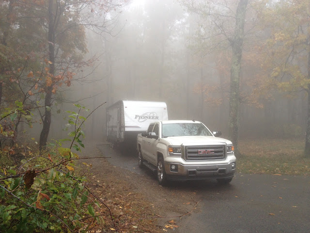
Donna and I took a four day trip to Mt. Magazine State Park staying in the Cameron Bluff Campground. We had site #17 reserved for about 8 months anticipating the campground being packed with campers there to see the fall leaves. The campground was in fact completely booked.
At over 2700 feet the climate can change dramatically on top of Mt. Magazine. Driving up on Wednesday afternoon we had a partly cloudy sky at the base of the mountain in Paris. By the time we reached the visitor center we were down to about 50' visibility. We had to creep into the visitor center parking lot without the building or the parking lot visible. We saw two white lines that said RV Parking on the asphalt and pulled straight in. From across the parking lot we could barely see the visitor center in the clouds.
Campsite #17 is the last campsite on the outside of the East loop. This gave us an almost completely private campsite with no neighbors beside our trailer.
Cameron Bluff Overlook Drive circles the campground. Although you can't see off the mountain from the campground you can take the short hike through the woods to the overlooks. Trees were starting to turn. We had one of the wetest summers on record in Arkansas and were hoping for spectacular colors, but after the driest September on record the leaf color was mostly yellows. Pictures from the bluffs were never the less pretty.


Cameron Bluff Campground is on the north side of the mountain just over the peak at Signal Hill. A south wind blew over the mountain top in eerie gusts much of the time that we were camping. The Mt. Magazine Lodge is on the south side of the peak and according to the visitor's center takes the brunt of the southwest winds with the campground being more protected.
We took a day trip on Saturday down to Paris. Donna always wanted to see the Eiffel Tower.
On Sunday our final day camping I had to take a hike to the top of Signal Hill. The trailhead is across the road from the campground. Only about 0.7 of a mile up to the top of Signal Hill where there is a stone monument. As described in the park brochure "The monument is an approximate 400 square foot map of Arkansas made of stone and mortar. It was built to the scale of one foot = 13 miles. The survey marker represents the location of Mount Magazine, between the Arkansas and Petit Jean Rivers. The map also shows the six natural divisions of Arkansas. It was constructed by state park personnel and members of Americorps Team Silver Seven in May 2003. The round trip over the top and down to the Lodge, then back around the north side of Signal Hill is about 1.5 miles.

 |
| Had to add this picture to prove I made it to the top of Signal Hill |
 |
| The Lodge as seen form the north trail head of Signal Hill |


No comments:
Post a Comment